
How do we explore and map fractures in rocks found more than 4 kilometres deep?
Our geologists have been doing just that using rocks exposed at the surface, which are expected to match the basement rocks residing deep underground. Scientists call these analogues — the shallow and deep rocks are related, sort of like cousins.
Why are fractures important?
Supercritical fluids in the Taupō Volcanic Zone (TVZ) circulate through cracks within greywacke basement rocks. Cracks can be thought of like roads, some are like wide highways (fault zones), others are like narrow and windy roads (fractures and veins). Like a road network, together the cracks form a fracture network.
In GNG’s EXPLORE project, we want to determine how these fractures form and where they are. We want to determine what controls the organisation of the fracture patterns, in order to identify 'sweet spot' locations where numerous and large open cracks host circulating supercritical fluids.
What are greywacke basement rocks?
Basement rocks are the thick foundation of ancient rock that forms the crust of continents, including Te Riu-a-Māui / Zealandia. The basement rocks in and around the Tauranga-Rotorua-Taupo area are greywacke, formed during the Jurassic and Cretaceous Periods (about 200-100 million years ago).
Greywacke and argillite are generic terms for hard sandstones and mudstones that have a long history of development. Greywacke rocks were formed in oceans by the accumulation of loose boulders, sand and mud. Then, these sediments were buried, and experienced heat and pressure. At this stage, a lot of the water and mud between the grains was squeezed out and the sediment became a rock.
Once hardened, the rocks were pushed and pulled in various directions, forming cracks and fractures. Some of these cracks got filled with white minerals, such as quartz and calcite. Eventually, some of the rocks made back it back to the surface. You can see where greywacke basement rocks reached the surface in New Zealand here, or explore this cool mapping tool.


Out in the Field: studying basement rocks …at the surface
No-one has been able to see the deep fracture network four or more kilometres deep below the surface. We obviously are constrained by limited access! But the surface rocks give us a glimpse of what’s down there and insight into the past dynamics.
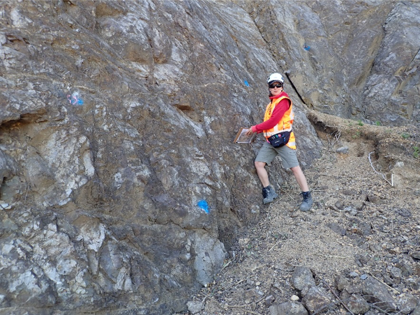
In late 2020, Siru Jylhänkangas (a summer scholarship student from Victoria University of Wellington) joined Regine Morgenstern and Cécile Massiot (from GNS Science) in field work at Whakatane Heads, and at Awakeri Quarry, between Kawerau and Whakatane.
Local geological conditions combined with all of the past pushing/pulling movement, means fracture patterns can vary a lot over small distances. At Awakeri Quarry, just outside the TVZ, greywacke rocks are exposed at the surface. Although there is no sign of geothermal heat in the quarry, the Awakeri Hot Springs are just up the road (and fantastic to relax after a day on the rock face). Meanwhile, at the Kawerau Geothermal Field, 15 km to the west and within the TVZ, greywacke rocks have been drilled >1 km deep, buried beneath volcanic deposits. There, geothermal fluids over 300°C are used to generate electricity and provide heat for industrial processes, such as timber drying and paper making.

The team measured the patterns of fractures and veins in an outcrop ~10 metres high, on a road several hundred meters long. This is a common distance between drill-holes in a geothermal field. Most of the veins are a few centimetres wide, like those recovered from deep rock samples.
To capture this fracture pattern objectively and quickly, we used a technique called photogrammetry, or structure-from-motion. We took thousands of high-resolution photographs via drone. These photographs were then assembled like a jigsaw puzzle by a computer. Then, we drew the fractures and veins on the joined pictures, and noted the rock type, size, orientation and connected/unconnected nature of the veins and fractures.

At Whakatane Heads (apparently a good fishing spot!) we didn’t use the drone, instead we made observations by eye and hand. We found similar patterns as in the quarry, but also different structures such as folds (where rock layers are bent) and an old fault (where layers have slid past each other). Each structure had its own fracture networks.
Back at the office, Siru compiled these observations and we will use the information to understand what effect the formation of fractures and circulations of fluids had on these rocks, and how the fracture and vein network varies over hundreds of meters.
Progressing this Work
In the GNG research programme, we are studying the rocks most related to the inaccessible TVZ basement rocks that host supercritical fluids at depth. We do this in four ways:
Put together, these different points of view help to build a picture of fracture patterns in the basement rock, and thus of supercritical fluid circulation in the depths of the TVZ.
We thank Mike Henton and Dudley Clemens at J-swap for permission to access to the Awakeri Quarry, and for their support and kindness.